One of the key elements that got me interested in earth sciences in college was the ability to look at a landscape, or more specifically, a rock outcrop, and have a clue about what happened there before. Were there rivers here? Oceans? Shorelines? Volcanoes? Big earthquakes? I loved being able to see and ‘read’ a place like a book and get a story through the rocks. I still love that.
Being involved in natural resources management, I get to rub elbows continually with fellow earth science nerds whose passion mirrors mine but in other elements of the landscape and ecosystem. Last fall I had the chance to join Jay Riggs, District Manager of the Washington Conservation District (WCD), on a site visit at Afton Alps near Afton, Minnesota. We met up with representatives from the South Washington Watershed District, the Minnesota Board of Water and Soil Resources, the Minnesota Department of Natural Resources (DNR), and Houston Engineering to look at a project area near Trout Brook near the bottom of the ski slopes. One of the questions that needed answering was whether Jay, our wetland expert, agreed with the wetland delineation (a practice where you map wetland boundaries) completed by team member on the project.
We fanned out on the landscape, and I soon realized that I had absolutely no idea what I was looking at or what to look for. Jay and the crew started talking about vegetation changes, changes in soil texture, and pointing out how the land sloped this way or that and what that meant. There was no open water except for the stream working itself through the land, and yet, yellow flags mapping the wetland boundaries were everywhere. Jay and the team were reading the landscape, but in a way that was completely foreign to me.
It was way fun, and I enjoyed peppering the team with questions so I could start to train my eye a bit, but mostly I walked out of there thinking, “Wetlands are WAY harder to get than rocks. Thank god for the wetland nerds.”
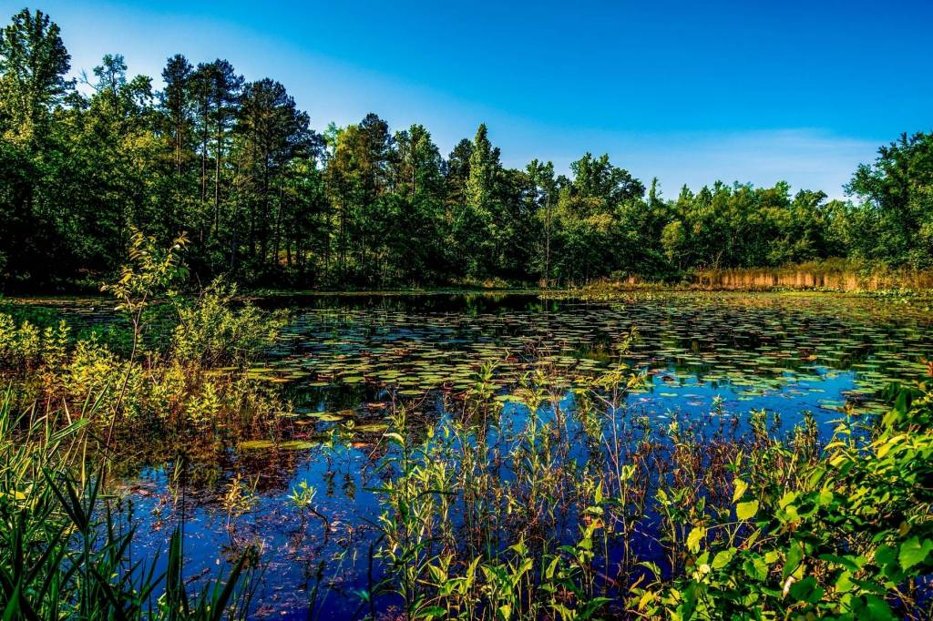
And the thing is, wetlands ARE hard. My mental image when somebody says ‘wetland,’ is a relatively small, shallow, open pool of water surrounded by cattails with some lily pads and frogs and waterfowl. That’s it. Yet, I’m quickly learning that wetlands can look incredibly different and are much more pervasive than we might think. Historically, studies estimate that Minnesota had approximately 20 million acres of wetland prior to European settlement. Today, we have about half that – about 10.6 million acres.
And the thing is, those 10.6 million acres can look so different and occur in so many different places across the landscape. At it’s core definition, a wetland is any land or area that is wet or saturated for 2 or more weeks during the growing season and has wetland soils and plants. There are 8 different types of wetlands (see infographic below) and the classification systems used to categorize and describe the wetland types are varied, complex, and full of technical nomenclature and acronyms. For most of us, talking wetlands can be truly overwhelming.

Yet, wetlands are incredibly important landscapes that provide us so many benefits – flood and erosion control, nutrient processing/filtering, and a biodiversity of plants and animals that rivals rainforests and coral reefs. Wetlands are really super cool. Hence, it’s not really surprising that wetlands are protected by federal and state laws, and in some areas, local ordinances. In Minnesota, the Wetland Conservation Act (WCA) is the most well known wetland protection law. It is implemented by local governments, with the Minnesota Board of Water and Soil Resources providing administrative oversight, and the Minnesota Department of Natural Resources providing enforcement.
Thing is, the state law applies to all wetlands, including those found on private land, and it regulates the activities that can occur in or near wetlands, including draining, filling, or excavating.
If you own land, and are contemplating a project this year that includes:
- filling a low area for a building or lawn
- digging a pond
- draining a wet area, or
- cleaning out an old ditch,
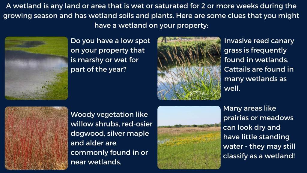
it is in your best interest to make sure that you’re not going to impact a wetland or you might be subject to costly and time-consuming enforcement and restoration actions. The graphic below provides some basic tips regarding whether or not an area could be a wetland, but in the end, it’s best to reach out to your local WCA regulatory authority to help you (see table below) They can determine if the area is a wetland, how it might be impacted, what permits you might need to proceed forward, and how to mitigate any impacts.
I look forward to continuing my landscape education by joining more site visits this spring, and perhaps after seeing a few more wetlands, I’ll better be able to answer the question, “Is it a wetland?”
If you are interested in learning more about wetlands, WCA, or about how to add native plants and landscaping to protect wetlands, check out our recording of our Wonderful Wetlands workshop from November 2021.
Local WCA regulatory authorities throughout the Lower St. Croix watershed:*
| Washington County | Washington Conservation District – Jay Riggs jriggs@mnwcd.org or call 651-330-8220 (ex. 20) |
| Chisago County | Chisago County – Jeff Fertig, Wetland Specialist, 651-213-8370 |
| Chisago Soil and Water Conservation District – Craig Mell, 651-674-2333 | |
| Isanti County | Isanti County Zoning – Darrick Wotacheck, 763-689-5165 |
| Anoka County | Anoka SWCD – Becky Wozney – 763-434-2030 (x140) |
| Pine County | Pine County Planning & Zoning – Jeremy Williamson, 320-216-4220 |
*if in doubt, your county soil and water conservation district is a great place to ask for more information
